Cotuí
Cotuí is a city in the central region of the Dominican Republic and is one of the oldest cities of the New World. It is the capital of Sánchez Ramírez Province in the Cibao.
According to the Population and Housing Census, the municipality had a total urban population of 79,596 inhabitants.
It was founded in 1505 by Rodrigo Trillo de Mejía for order of Nicolas de Ovando, who was the governor of Hispaniola. Its name, formerly written Cotuy, was the name of the Taino community located around the gold and silver mines exploited by the Spanish conquerors from the first decade of the 16th century.
Map - Cotuí
Map


Country - Dominican_Republic
 |
 |
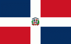
| Flag of the Dominican Republic | |
The native Taíno people had inhabited Hispaniola before the arrival of Europeans, dividing it into five chiefdoms. They had constructed an advanced farming and hunting society, and were in the process of becoming an organized civilization. The Taínos also inhabited Cuba, Jamaica, Puerto Rico, and the Bahamas. The Genoese mariner Christopher Columbus explored and claimed the island for Castile, landing there on his first voyage in 1492. The colony of Santo Domingo became the site of the first permanent European settlement in the Americas and the first seat of Spanish colonial rule in the New World. It would also become the site to introduce importations of enslaved Africans to the Americas. In 1697, Spain recognized French dominion over the western third of the island, which became the independent state of Haiti in 1804.
Currency / Language
| ISO | Currency | Symbol | Significant figures |
|---|---|---|---|
| DOP | Dominican peso | $ | 2 |
| ISO | Language |
|---|---|
| ES | Spanish language |